
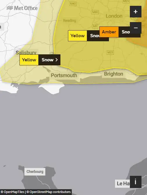
The Met Office forecast snow for parts of the Isle of Wight from midnight on Sunday until midnight on Wednesday.
The weather warning for snow reads:
Heavy snow at times will bring some travel disruption.
What to expect
- Possible travel delays on roads stranding some vehicles and passengers
- Possible delays or cancellations to rail and air travel
- Some rural communities could become cut off
- Power cuts may occur and other services, such as mobile phone coverage, may be affected
Rain will turn increasingly to snow during Saturday evening, with snow likely to become widespread, occasionally heavy and persistent by Sunday morning.
There remains some uncertainty with the location of the heaviest snowfall and therefore the greatest disruption, most likely towards the east coast.
Widespread accumulations of 1-3 cm are likely, with 5-10 cm possible in places. Over higher ground and across eastern areas, e.g. The Kent Downs, 15-20 cm is plausible.
A brisk easterly wind, strong along eastern coasts, may add to travel disruption.
Follow updates to the snow warning on the Met Office Website.
Image: Aaron Burden under CC BY 2.0