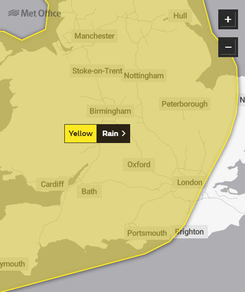
Later this week the Isle of Wight is on the edge of two severe weather warnings for heavy rain/thunderstorms and strong winds from the Met Office.
Friday’s warning
Valid between from midnight on Thursday until midnight on Friday, the warning reads:
A band of heavy rain followed by heavy showers or thunderstorms has the potential to bring disruption.
What to expect
- There is a small chance that homes and businesses could be flooded, causing damage to some buildings
- There is a small chance of fast flowing or deep floodwater causing danger to life
- Where flooding occurs, there is a slight chance of delays or cancellations to train and bus services
- Spray and flooding could lead to difficult driving conditions and some road closures
- There is a small chance that some communities become cut off by flooded roads
A band of heavy rain, with the possibility of some very heavy bursts, will move northwards during Thursday night and Friday. Within this band 10-15 mm is widely expected, however some places could see as much as 30 mm in just a few hours.
Once the rain has cleared scattered showers and thunderstorms are expected to develop, particularly during Friday. Many places will miss these, but where they do occur 10-20 mm is possible in one hour, with perhaps 30 mm in a few hours.
Saturday’s warning
Then for the entire 24 hours of Saturday, there’s a severe weather warning for wind across the Isle of Wight. The warning reads:
What to expect
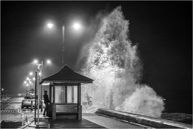
- It’s likely that some coastal routes, sea fronts and coastal communities affected by spray and/or large waves
- Some short term loss of power and other services is possible
- Delays for high-sided vehicles on exposed routes and bridges likely
- Probably some bus and train services affected, with some journeys taking longer
- Some delays to road, rail, air and ferry transport are likely, with some fallen trees possible
Unseasonably strong southwesterly winds are expected to cause some disruption, with gusts over 40mph possible quite widely inland. Gusts over 50mph are possible along some coasts of the Bristol Channel, English Channel and through the Strait of Dover.
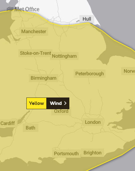
Image: © Jamie Russell Island Visions